Remote Sensing Digital Image Analysis

Деталі
Ціни

Відгуки
Remote Sensing Digital Image Analysis
Ще ніхто не оцінив.
Про книжку
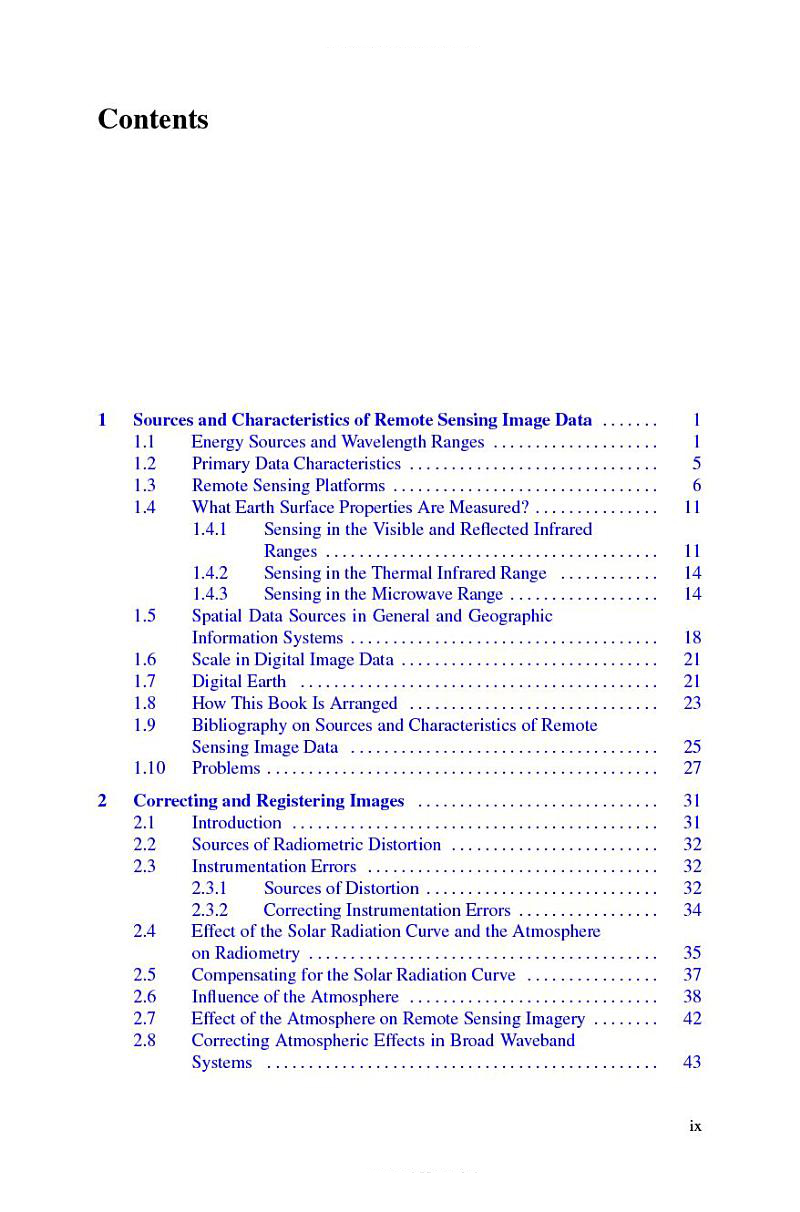
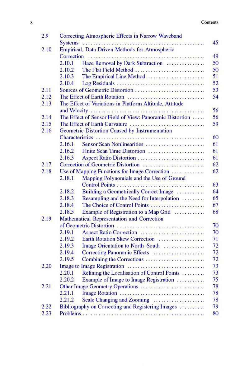
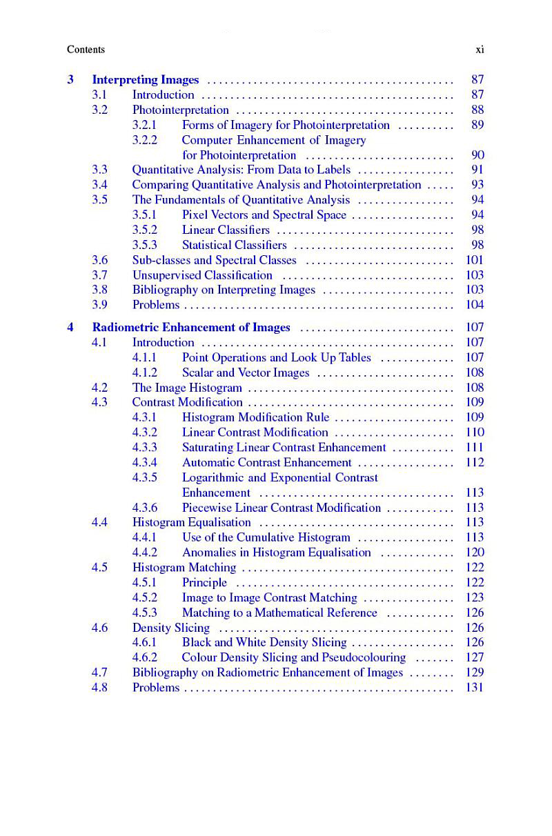
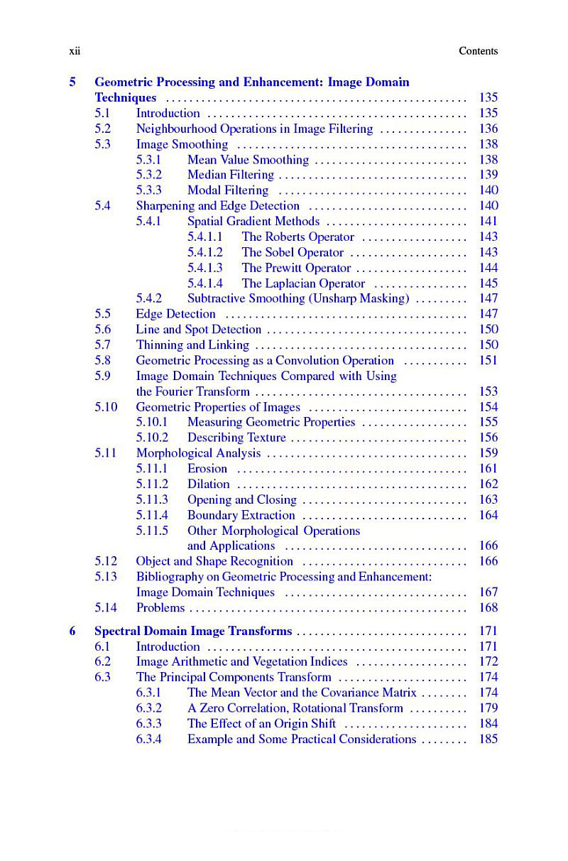
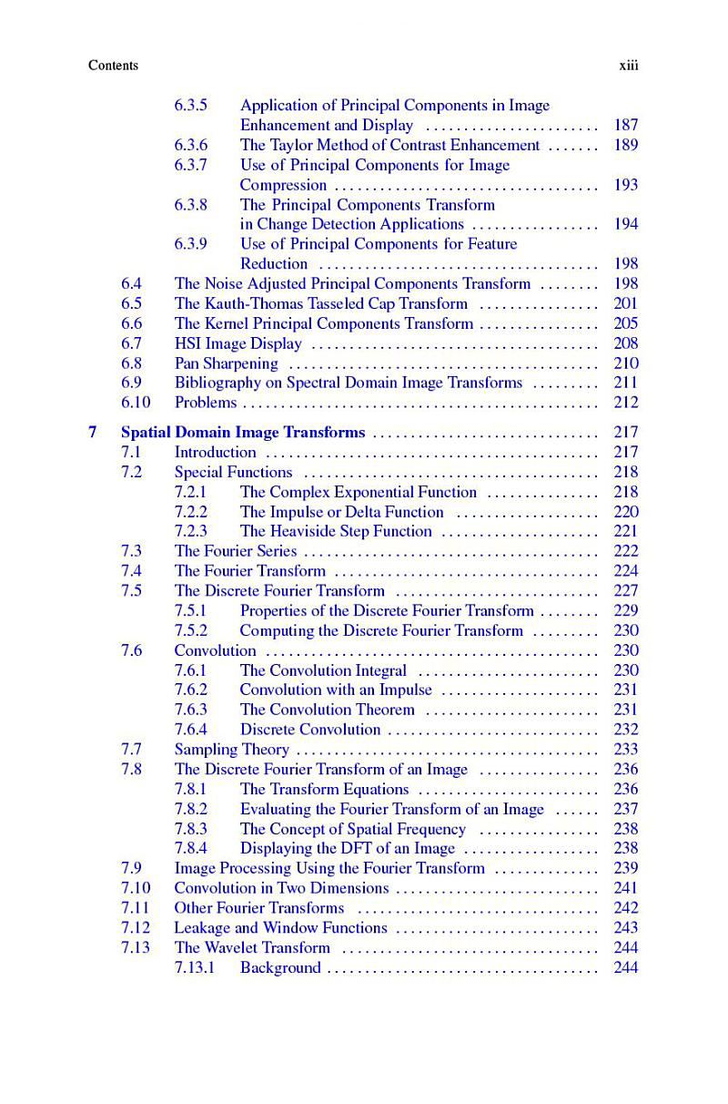
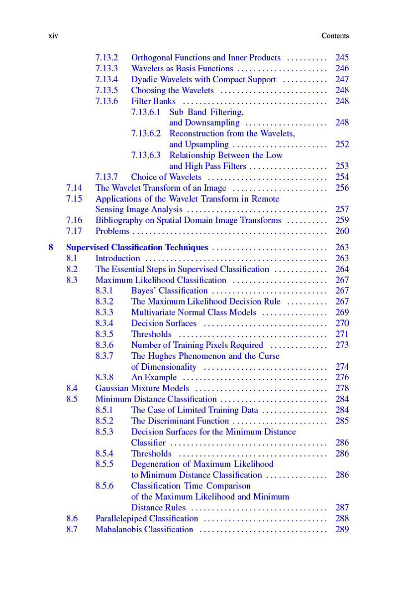
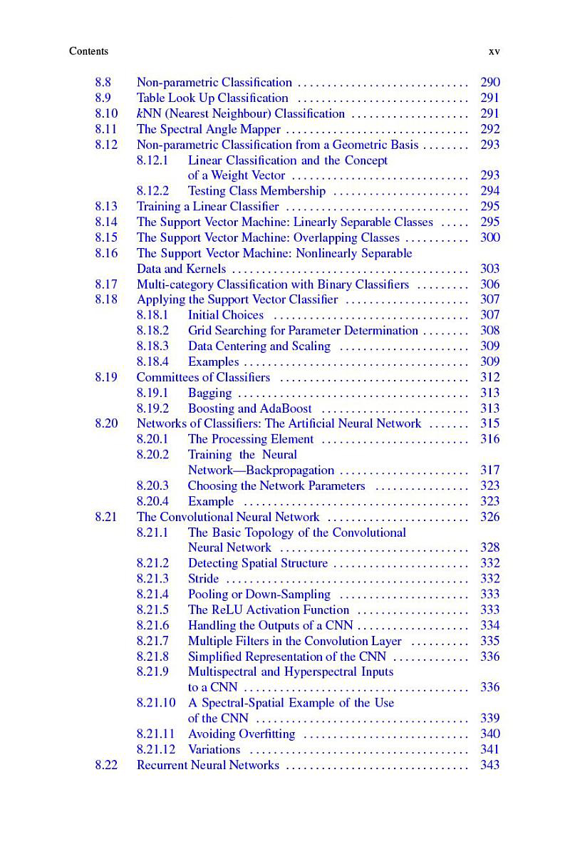
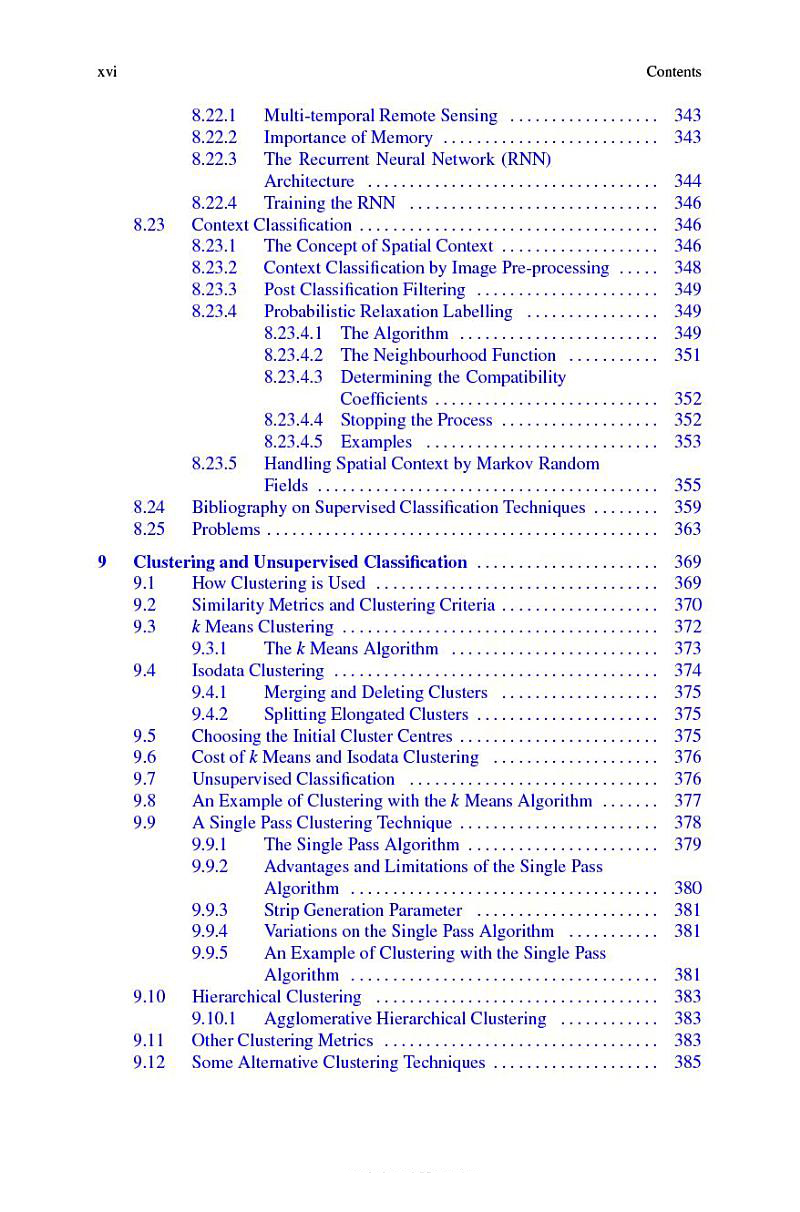
Remote Sensing Digital Image Analysis provides a comprehensive treatment of the methods used for the processing and interpretation of remotely sensed image data. Over the past decade there have been continuing and significant developments in the algorithms used for the analysis of remote sensing imagery, even though many of the fundamentals have substantially remained the same. As with its predecessors this new edition again presents material that has retained value but also includes newer techniques, covered from the perspective of operational remote sensing.
The book is designed as a teaching text for the senior undergraduate and postgraduate student, and as a fundamental treatment for those engaged in research using digital image analysis in remote sensing. The presentation level is for the mathematical non-specialist. Since the very great number of operational users of remote sensing come from the earth sciences communities, the text is pitched at a level commensurate with their background.
The chapters progress logically through means for the acquisition of remote sensing images, techniques by which they can be corrected, and methods for their interpretation. The prime focus is on applications of the methods, so that worked examples are included and a set of problems conclude each chapter.
Деталі
- Видання
- Springer, 2022, паперова
- Видавництво
- Springer
- Сторінок
- 567
- Мова
- Англійська
- ISBN
- 9783030823269
Відгуки
Відгуків ще немає.
Ціни 1 пропозиція
Деякі посилання на магазини — партнерські, ми можемо отримати невеликий відсоток від магазину, але це не впливає на порядок пропозицій на сайті.